Revolutionary War Map Donated to Mount Kisco

A piece of Revolutionary War history has been donated to the Village of Mount Kisco.
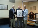
Bedford residents Herb Kaufmann and Peter Milano last week gave one of two copies of the July 1781 map of the French Army encampment, which took place in the village, to local officials. Mayor Michael Cindrich said the map will initially be placed in the Frank J. Dimicco Sr. Board Room in village hall before eventually being given to the Mount Kisco Historical Society to display.
“This is of some historical significance,” said Cindrich, who thanked Milano and Kaufmann for the donation.
The map was drawn by Louis-Alexandre Berthier, Rochambeau’s cartographer, who later became Napoleon’s chief of staff, he said. The original map is kept at the Firestone Library at Princeton University, where Kaufman and Milano received two copies.
Milano said the map shows the encampment of the French army under the command of General Count de Rochambeau. The camp was located in the area where Northern Westchester Hospital, Leonard Park and McLain Street is now located, he noted.
Milano said the French marched from Rhode Island to Dobbs Ferry to meet General George Washington’s army. Washington’s troops had marched from White Plains, he said.
“In August the joined armies marched over 400 miles to Chesapeake Bay where they, with a French navy, by late September maneuvered to isolate and defeat Cornwall’s army in Yorktown, Va., effectively ending the Revolution,” Milano said.
